Climate—Conflict—Vulnerability Index
Climate—
Conflict—
Vulnerability
Index
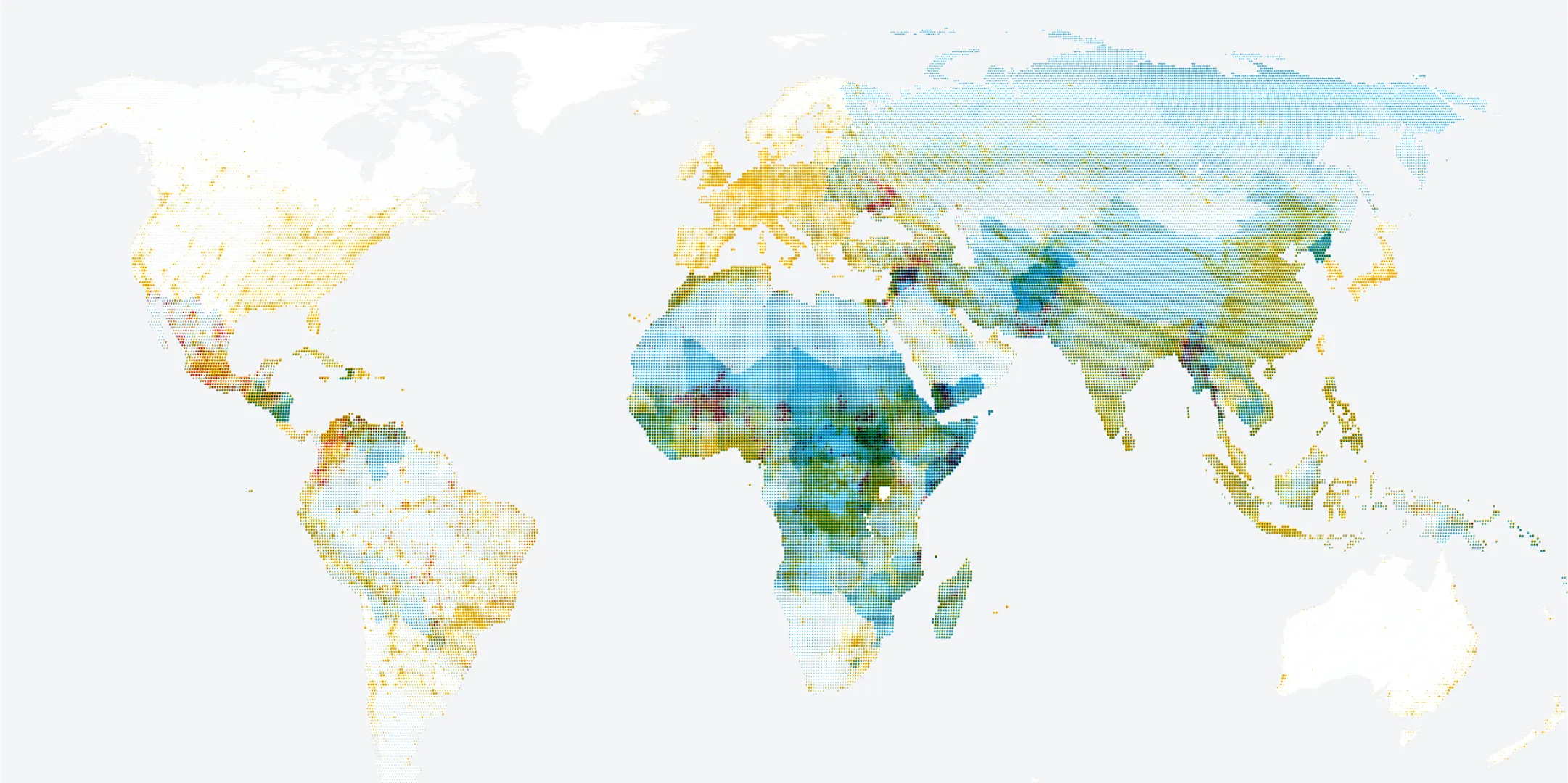
The Climate—Conflict—Vulnerability Index (CCVI) maps current global risks by integrating climate and conflict hazards with local vulnerabilities.
Get the latest data
Latest quarter: Q1-2025
Index architecture
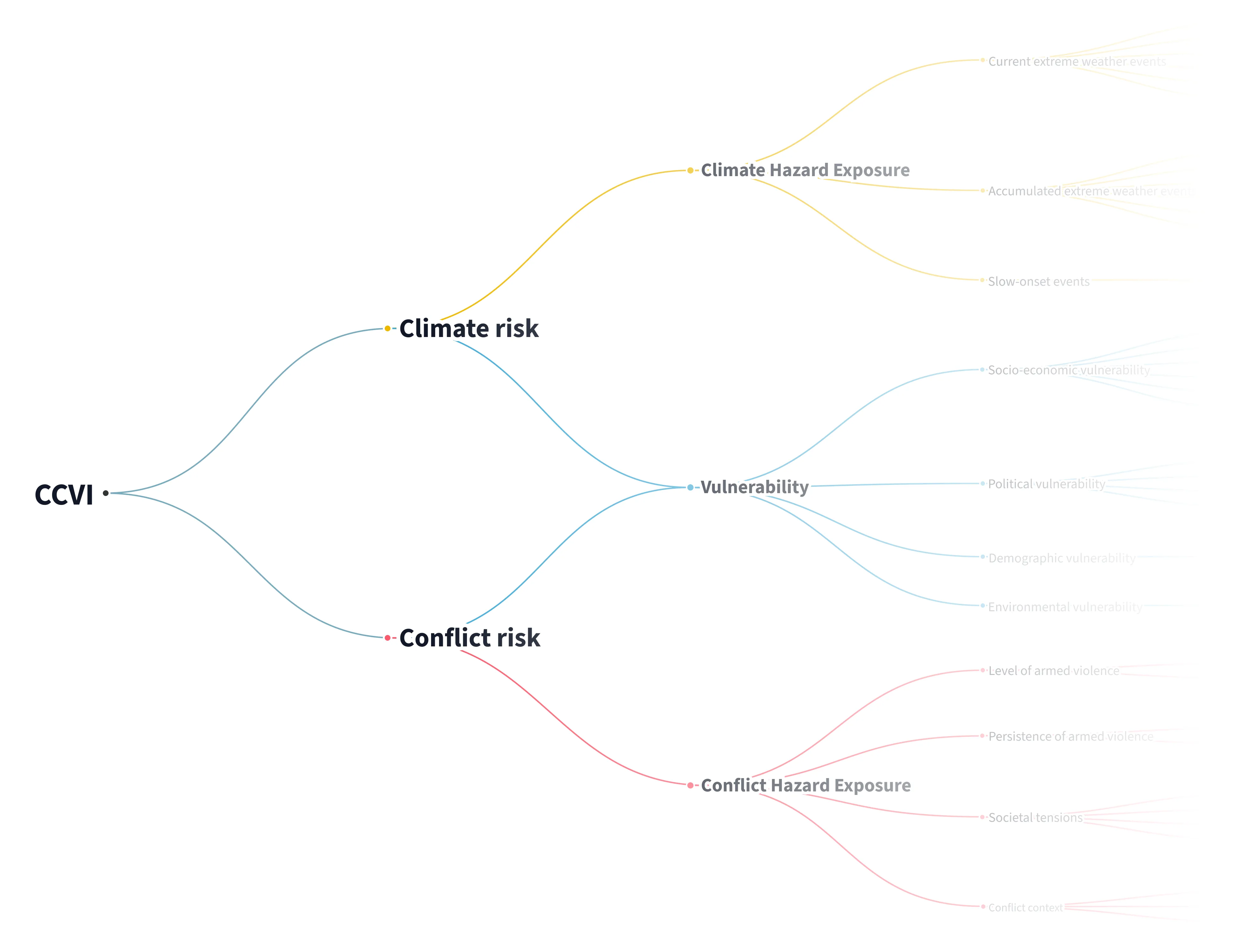
The CCVI metrics are organized hierarchically in three pillars — climate, conflict and vulnerability.
Each pillar is based on indicators from publicly available sources, which are further grouped into dimensions.
Following the IPCC definition, risk metrics are computed as a function of hazards, exposure and vulnerability.
Explore the data
The index comprises a harmonized set of data layers and a transparent scoring methodology to make regions globally comparable.
The data is updated quarterly and gridded to 0.5 degrees (ca. 55km by 55km at the equator).
About
Initiated and commissioned by the German Federal Foreign Office, the CCVI is created and evaluated in the context of a multi-year, interdisciplinary research effort.

Project timeline
Pre-project
October 2022Launch of precursor project "Climate Conflict", now archived at 2022.climate-conflict.org
Project start
January 2023Start of current CCVI research project
Public launch
October 2024The first public version is available.
Open source version
Early 2025Release of code as open source version.
Evaluation and ongoing improvements
2024–2025The index is evaluated, continuously improved and updated with quarterly data updates.
Stable, validated index
End 2025All project documentation and outputs are available in a stable, validated form.
Get in touch
Please reach out in case you have any questions or feedback. We are happy to help.
Send email